Field Boundary Set Up
Note: An external field boundary is required for every OMNiDRIVE™ operation to set the bounds for the autonomous tractor and grain cart.
Field boundaries may be either created within the OMNiDRIVE™ user interface or uploaded with a shape (.shp) file.
Create a Boundary
To draw an external field boundary in the OMNiDRIVE™ user interface:
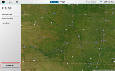
- Select the Field Settings icon along the top of the screen.
- Select the Add Field button in the lower, left corner of the screen.
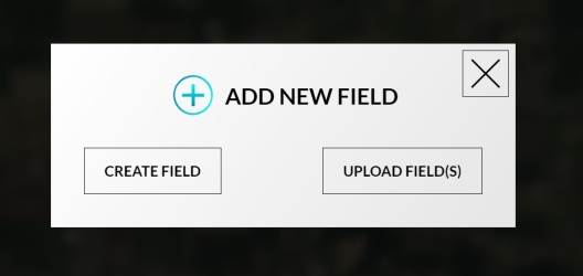
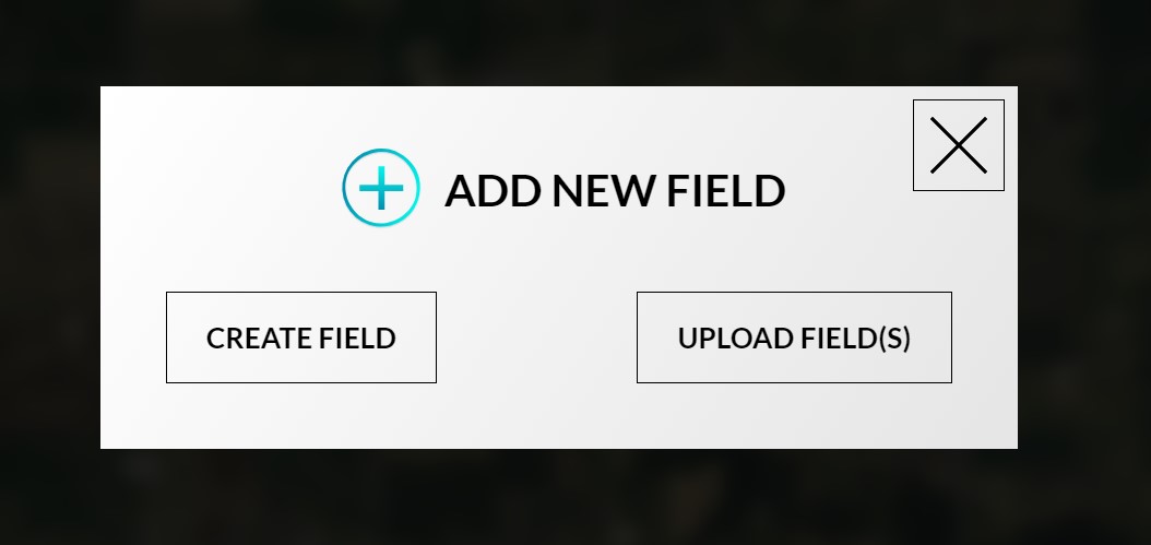
- Select the Create Field button.
- Select the Draw Boundary tool and tap around the edges of the field to draw a boundary.
- Double tap on the last point to create the boundary.
- Select the Save & Exit button to save the boundary in the OMNiDRIVE™ user interface.

Upload a Boundary
To load an existing shapefile![]() A shapefile is a vector format consisting of a .shp, .shx, and .dbf file and is used to store geospacial data and information such as field boundaries, product application coverage, and waypoints. for the OMNiDRIVE™ external boundary:
A shapefile is a vector format consisting of a .shp, .shx, and .dbf file and is used to store geospacial data and information such as field boundaries, product application coverage, and waypoints. for the OMNiDRIVE™ external boundary:
- Select the Field Settings icon along the top of the screen.
- Select the Add Field button in the lower, left corner of the screen.
- Select the Upload Fields button.
- Browse for the field shapefiles to load them into the OMNiDRIVE™ user interface.

Last Revised: Jul 2024