Terrain Compensation Calibration
-
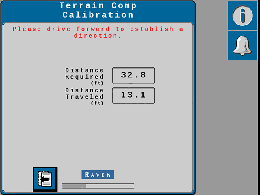
Drive the machine forward at least 10 m [33 feet] and park on a flat surface.
Note: The system must detect a converged GNSS
 Global Navigation Satellite System status and the direction of forward travel to properly calibrate the terrain compensation features.
 -
Place flags or markers on each side of the implement working point.
notice

For best performance, lower the implement to the ground when performing the following terrain compensation calibration.
The implement may be raised off of the ground when moving to reposition between the flags.
-
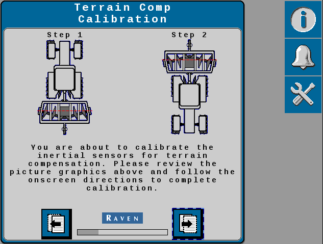
Select the Next button and follow the on-screen instructions to begin the terrain compensation calibration.
-
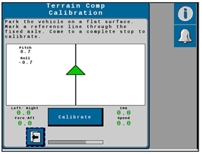
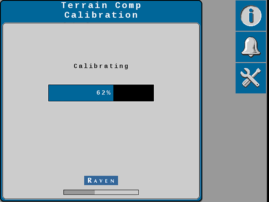
Select the Calibrate button and wait for the gyro calibration to complete.
Note: Do not move the machine or implement during the calibration. Wait for the calibration process to complete before moving the machine.
-
After the gyro calibration is complete, drive forward and turn the machine around (180°).
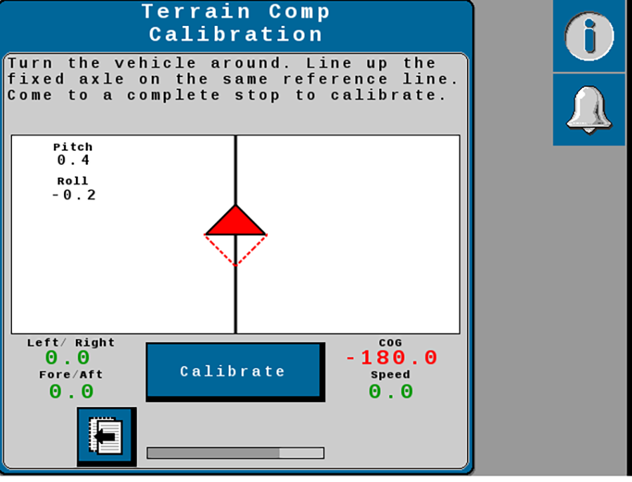
Note: The two triangles on the display should line up on top of each other when the machine or implement is in the correct position.
notice
For best performance, lower the implement to the ground when performing the following terrain compensation calibration.
The implement may be raised off of the ground when moving to reposition between the flags.
-
Select the Calibrate button again and allow the gyro calibration to complete.
-
Select the Next arrow.
-
Proceed to the Auto-Steer Calibration procedure.
Last Revised: Jul 2024